|
|
Demonstrations |
|
These maps and the scripts that produced them
are all public domain.
Click a thumb to see the full-size original, or on the image title to see its script.
 |
 |
| Projection sampler | Modified Stereographic projection
of the 50 United States Parameters from Snyder's "Working Manual". |
 |
 |
| Modified Stereographic projection of Alaska Parameters from Snyder's "Working Manual". |
Earthquake activity near New Zealand, 1980s Preliminary Determination of Epicenters dataset. |
 |
 |
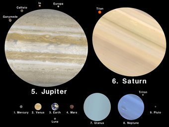
| Planets to scale (with skins) | Hill shading demonstration |
 |
 |
| Global choropleth using WHO SARS data | Exaggerated rising sea levels |
 |
 |
| Goode Homolosine demonstration | Scale distortion patterns |
 |
 |
| Choropleth demonstration (US counties) | Fill examples |
 |
 |
| California faults and earthquakes | Classroom-style map of the 50 United States |
 |
 |
| United States choropleth example | Globular projections sampler |
 |
 |
| Global choropleth using World Factbook | Mollweide interrupted to best display oceans |
